Saturday, Sep 20, 2025 @ 7:00 AM
This Event Took Place Sat. Sep 20, 2025
About
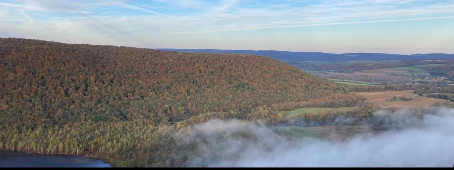
SCTR is excited to announce the second running of the Hill to Hollow 100km, co-directed with Pete Dady of the Hash House Harriers. Crossing four counties, the course will begin and end in Morgan Hill State Forest (camping available), following the nearly-all-single-track Onondaga Trail alongside misty ponds, up to incredible vistas, and crossing above waterfalls. The course then follows the Onondaga Trail/North Country Trail east to Highland Forest County Park and past DeRuyter Reservoir, turning south on the enigmatic Link Trail through Muller Hill State Forest before joining the main Finger Lakes Trail in Mariposa State Forest, heading west past Chippewa Falls, and rejoining the Onondaga Trail to reenter Morgan Hill State Forest.
This is a challenging 100km, so self-sufficiency and strong navigation skills (without 5G/LTE network coverage) are musts. Required gear includes: fully charged cell phone kept turned on during race with RD phone number saved; navigation device capable of functioning offline (without 5G/LTE network coverage) with course GPS file loaded, headlamp with extra batteries, reflective vest, emergency blanket, waterproof shell with hood, water filtration device, ≥800mL liquid storage capacity & ≥400 kcal food reserve.
Aid station offerings will include ice (if temperatures merit), water, Skratch, orange slices, bananas, pickles, PB&Js, potato chips, pretzels, oreos, and candy. A limited selection of hot foods (e.g., ramen, grilled cheese, pierogi, etc.) will be available at AS#7. For 2026, crew may assist runners anywhere on the course so long as they do NOT park on private property. All aid stations are accessible but road conditions may not be suitable for vehicles with low ground clearances. 100km solo runners (not relay) may have pacers after mile ~29.3/AS#4, only one pacer per runner at a time. Pacer/relay runner changes are only allowed at aid stations.
It takes a tremendous amount of work by a great many people and organizations to provide public access to and maintain the beautiful land and trails upon which these races depend. SCTR is immensely grateful to NYS DEC, Finger Lakes Trail Conference, North Country National Scenic Trail Association CNY Chapter, Highland County Park, the ADK-Onondaga Chapter, and the many private landowners, trail stewards, and volunteers without whom this would not be possible. Please consider making a donation to the FLTC during registration; SCTR will match donations up to $250. Or better yet, become a member at https://fingerlakestrail.org.
All runners will receive a pair of highly coveted SCTR socks and finishers will receive a limited edition, hand glazed mug. Prizes will be awarded to the top finishers in each gender division and the fastest relay team. Hill to Hollow 100km take place concurrently with the Morgan Hill Trail Races Half Marathon & Marathon, is Trail Sisters approved, and is a UTMB Index race.
Course Details
Distance: ~62.5 miles
Elevation Change: ~10,423 feet
Hard Cutoff: 2:30am (20 hours)
Aid Stations: 8 (excluding Start/Finish)
Start/Finish (Morgan Hill Rd DEC Camping Area)
Location: 42°46'06.4"N 76°00'05.9"W)
Mile: 0, 6.5 miles to next AS
Leg 1: https://www.plotaroute.com/route/3432054
Aid Station 1 (Herlihy Rd)
Location: 42°48'40.6"N 76°01'45.7"W
Mile 6.5, 7.8 miles to next AS
Leg 2: https://www.plotaroute.com/route/3432057
Aid Station 2 (Bardeen Rd DEC Fishing Access Parking)
Location 42°48'21.7"N 75°57'57.2"W
Mile 14.3, 7 miles to next AS
Leg 3: https://www.plotaroute.com/route/3432061
Aid Station 3 (East Lake Rd Parking)
Location: 42°49'33.5"N 75°53'22.0"W
Mile 21.3, 8 miles to next AS
Leg 4: https://www.plotaroute.com/route/3432063
Aid Station 4 (Corkinsville Rd Parking)
Location: 42°51'01.1"N 75°49'28.7"W
Mile 29.3, 7.2 miles to next AS
Soft 3:30pm cutoff
Leg 5: https://www.plotaroute.com/route/3432067
Aid Station 5 (Three Springs State Forest)
Location: 42°47'19.5"N 75°49'25.8"W
Mile 36.5, 6 miles to next AS
Soft 6:00pm cutoff
Leg 6: https://www.plotaroute.com/route/3432069
Aid Station 6 (Crumb Hill Rd)
Location: 42°44'33.2"N 75°48'08.2"W
Mile 42.5, 6.3 miles to next AS
Hard 8:00pm cutoff
Leg 7: https://www.plotaroute.com/route/3432070
Aid Station 7 (Paradise Hill Rd Parking)
Location: 42°43'30.9"N 75°51'31.0"W
Mile 48.8, 8.7 miles to next AS
Hard 10:00pm cutoff
Leg 8: https://www.plotaroute.com/route/3432072
Aid Station 8 (Rt 13 DEC Fishing Access Parking)
Location: 42°43'25.9"N 75°58'18.5"W
Mile 57.5, 4.9 miles to the finish
Hard 1:00am cutoff
Leg 9: https://www.plotaroute.com/route/3432074
Refunds, Deferrals, and Distance Changes
Refunds will not be granted under any circumstances. Deferrals are available in case of pregnancy, injury, or electing to volunteer at the race provided volunteer slots remain. Distance changes are permitted until online registration closes.
Event's current local time: 11:10 PM ET
